

Public travel plan
A 90-Day Bikepacking Expedition Through Colombia’s Mountains and Páramos
This is a source-faithful, highly demanding bikepacking route based on a three-month journey through Colombia. Plan for long climbs, frequent rain, muddy and rough roads, high-altitude exposure above 3,500 meters, and s…
Source videos
Travel inspiration behind this plan
Plan notes
Useful context before you go
This is a source-faithful, highly demanding bikepacking route based on a three-month journey through Colombia. Plan for long climbs, frequent rain, muddy and rough roads, high-altitude exposure above 3,500 meters, and sudden temperature changes. Carry reliable rain protection, warm layers, gloves, spare brake and drivetrain parts, water filtration or purification, offline maps, lights, repair tools, and enough food for isolated stretches. The journey works best with a flexible pace: rest in towns such as Medellín, Salento, Villa de Leyva, San Gil, and Santa Elena, and allow extra time for weather delays. The route includes camping opportunities, informal hospitality, a free cyclist hostel in Medellín, and a long bus transfer with the bicycle. The creator’s route resource may help with detailed navigation, but the supplied material does not provide a complete turn-by-turn map. Colombian rainy-season conditions can change quickly, especially in the páramos; never begin a high-altitude crossing without checking weather, daylight, road conditions, and shelter options. Spanish phrases for asking directions, requesting a covered place to camp, and explaining that you are traveling by bicycle will be useful.
Resources for this plan
Shared by the source creators. These are not VibePlanit endorsements and may be affiliate links.
Itinerary highlights
What is in this plan
Days 1-7: Caribbean Arrival and the Climb to Medellín
Begin inland from the Caribbean after the multi-boat crossing around the Darién Gap. The first week follows the main highway toward Medellín, with a good shoulder, steady climbing, views, and hot rainy-season showers. Treat this as an acclimatization block rather than a sightseeing stop.
-
Darién GapDarién Gap, Colombia
This is the Colombian starting point after three days of boats around the Darién Gap. Confirm that the bicycle is fully assembled and that food, water, and dry bags are ready before beginning the highway climb.

-
Medellín HighwayMedellín Highway, Colombia
Use the main highway as the practical inland corridor. The route has a useful shoulder and smooth climbing, but traffic and hot rain make bright lights, reflective clothing, and waterproof storage important.
-
MedellínMedellín, Antioquia, Colombia
Reach Medellín after approximately five days of climbing. Use the city for recovery, food resupply, laundry, bicycle checks, and a proper weather reset before leaving the highway.
-
MedellínMedellín, Antioquia, Colombia
Stay at Yerry’s Casa de Ciclista if available. It is described as a free hostel for cyclists and is particularly useful after the first demanding highway week.
-
MedellínMedellín, Antioquia, Colombia
Use the Sunday car-free cycling section leaving Medellín as an easy first ride outside the city. The final five kilometers were closed to cars and shared by cyclists, runners, walkers, and dogs.
-
Old Railway Tunnels and ViaductsOld Railway Tunnels and Viaducts near Medellín, Antioquia, Colombia
Follow the old railway alignment toward the tunnels and viaducts only if comfortable with narrow, exposed cycling infrastructure. The path includes dark tunnels, skinny viaducts, planks, and less-traveled sections.
Days 8-20: Antioquia’s Mountain Town Circuit
Spend roughly two weeks moving through small mountain towns. Expect steep daily climbing, painted houses, dirt roads, water crossings, and informal route decisions. Build in recovery days when the weather or elevation makes the next stage unsafe.
-
FredoniaFredonia, Antioquia, Colombia
Use Fredonia as the first small-town stop after the old railway section. It was reached after crossing the viaducts and provides a natural point to rest before the demanding climb toward Jericó.
-
JericóJericó, Antioquia, Colombia
The approach to Jericó is only about 22 kilometers but includes approximately 1,500 meters of climbing. Start early, carry enough water, and treat the climb as a full-day effort rather than a short transfer.
-
JardínJardín, Antioquia, Colombia
Jardín is a compact, attractive town and a useful pause in the mountain circuit. Use it to recover before the next mountain crossing and to enjoy the painted houses at a slower pace.
-
IrraIrra, Caldas, Colombia
Use Irra as a route checkpoint while crossing toward Manizales. The route involves another ten kilometers or so of climbing, so confirm water and daylight before leaving the previous town.
-
ManizalesManizales, Caldas, Colombia
Manizales marks the highland continuation of this mountain section. Expect elevation, rain, and significant climbs; use the city as a practical point for supplies and bicycle maintenance.
-
Antioquia Mountain Water CrossingsAntioquia Mountain Water Crossings, Antioquia, Colombia
Treat the seamless water crossings on this circuit as genuine hazards rather than minor inconveniences. Protect chain lubrication, keep electronics sealed, and inspect brakes after every deep crossing.
Days 21-32: Salento, the High Pass, and Semillas de Agua
Use Salento for planning and rest, then leave the tourist circuit for remote high-altitude roads. The Semillas de Agua reserve is a major physical and ecological highlight; arrive with shelter, warm clothing, and enough time to reach the camping area before dark.
-
SalentoSalento, Quindío, Colombia
Take several rest days in Salento after the tourist-town circuit. The town is touristy but offers a practical chance for coffee, carrot cake, route planning, and recovery before the remote section.
-
Salento Mountain PassSalento Mountain Pass, Quindío, Colombia
Leave the tourist circuit via the 20-kilometer mountain pass climb. This is a long, sustained effort before the remote route, so carry food and begin with dry clothing and a full water supply.
-
Wax Palm High Mountain RoadWax Palm High Mountain Road, Quindío, Colombia
The upper road reaches roughly 3,000 to 3,500 meters and enters a cloud-covered environment with wax palms. Prepare for cold, low visibility, and rapid weather changes despite the lower-elevation warmth earlier in the day.
-
Reserva Semillas de AguaReserva Semillas de Agua, Colombia
Reserve time for Reserva Semillas de Agua, an elevated wetland reserve whose name means “Seeds of Water.” The approach is a major climb, but the reserve provides a place to understand the páramo ecosystem and potentially camp.
-
Reserva Semillas de AguaReserva Semillas de Agua, Colombia
The reserve’s camping organization is approximately 1.5 kilometers from the upper approach and may provide a bed or camping access. Arrive before dark and do not assume late entry will be possible.
-
Semillas de Agua PáramoSemillas de Agua Páramo, Colombia
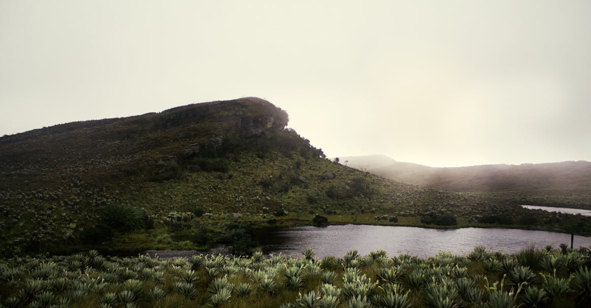
Hike the páramo with a park ranger if available. Frailejones collect water from passing clouds, store it, and release it slowly into the ground; avoid touching or damaging these exceptionally slow-growing plants.
Days 33-45: Santa Elena and the Route to Sumapaz
Descend from the páramo through severe rain and muddy roads, using Santa Elena as a drying and recovery base. Continue east and north through lower elevations before climbing again toward Sumapaz. This phase requires disciplined weather management and frequent bicycle maintenance.
-
Santa ElenaSanta Elena, Antioquia, Colombia
Santa Elena is the first practical recovery stop after the wet, high-altitude crossing. Use the town to dry clothing, inspect the bicycle, and restore energy before continuing east.
-
PlayarricaPlayarrica, Antioquia, Colombia
Continue east toward the warmer lowlands via the road to Playarrica. The change in elevation provides relief from the cold páramo, but keep rain protection accessible because the wet-season pattern remains unpredictable.
-
Alejandro's FarmAlejandro's Farm, Antioquia, Colombia
A roadside invitation near the lowlands provided a place to camp and perform bicycle maintenance. Informal hospitality can be part of this route, but always ask clearly and leave the site clean.
-
Magdalena RiverMagdalena River, Colombia
Cross the Magdalena River while repositioning north. The river marks a major geographic transition between the warmer lowlands and the next páramo-focused section.
-
La UniónLa Unión, Cundinamarca, Colombia
La Unión is a small-town waypoint before the final climb toward Sumapaz. Use it to secure food and water, because the next section returns to high elevation and exposed weather.
-
Páramo de Sumapaz ApproachPáramo de Sumapaz Approach, Cundinamarca, Colombia
Begin the approach to Sumapaz only after checking warmth, rain protection, and daylight. The route climbs toward one of the world’s largest páramo ecosystems and becomes significantly colder in prolonged rain.
Days 46-57: Sumapaz and the Long Northern Detour
This is the route’s most exposed high-altitude phase. Sumapaz can bring driving rain, cold, and long stretches without shelter. Camping inside the national park is not allowed according to the source, so plan around permitted lodging or shelter outside the park.
-
Sumapaz National ParkSumapaz National Park, Cundinamarca, Colombia
Enter Sumapaz National Park for the páramo landscape and extensive frailejones. The source describes millions of plants and calls the area one of the most beautiful sections of the journey.
-
Sumapaz High PassSumapaz High Pass, Cundinamarca, Colombia
Expect cold exposure at roughly 4,000 meters when rain continues. The journey demonstrated how quickly a rider can become dangerously cold; keep dry insulating layers in a waterproof bag and stop before hypothermia develops.
-
Sumapaz Park ShelterSumapaz Park Shelter, Cundinamarca, Colombia
Use the available accommodation outside the park rather than pitching inside the protected area. The source specifically notes that camping in the national park is not permitted.
-
Páramo de Sumapaz Eastern CrossingPáramo de Sumapaz Eastern Crossing, Cundinamarca, Colombia
Continue across the páramo after the overnight stop, allowing extra time for wet descents. At roughly 3,500 meters, five hours of rain can make the downhill more dangerous than the climb.
-
Sumapaz Rural Road ShopsSumapaz Rural Road Shops, Cundinamarca, Colombia
Use small roadside communities and shops to ask about road conditions before committing to remote shortcuts. The source shows that local answers may be cautious, especially after heavy rain.
-
Sumapaz Mountain ShortcutSumapaz Mountain Shortcut, Cundinamarca, Colombia
Follow the narrow mountain shortcut only when the road is passable and daylight remains. It saves approximately 30 kilometers but can turn muddy quickly and may become impassable during rain.
Days 58-69: Villa de Leyva and the Oh Boyacá! Route
Use Villa de Leyva as a proper recovery base before beginning the roughly two-week Oh Boyacá! bikepacking route. This phase shifts between colonial towns, highland roads, rain, sunshine, and improvised camping under roofs.
-
Villa de LeyvaVilla de Leyva, Boyacá, Colombia
Villa de Leyva is a colonial tourist town and a good location for several rest days after the Sumapaz detour. Recheck the bicycle, replace consumables, and prepare for a two-week route through Boyacá.
-
Oh Boyacá! Bikepacking RouteOh Boyacá! Bikepacking Route, Boyacá, Colombia
Start the Oh Boyacá! bikepacking route from Villa de Leyva. The source estimates approximately two weeks, so carry enough repair supplies and expect accommodation to vary between towns, farms, and improvised shelters.
-
PalermoPalermo, Boyacá, Colombia
Pass through Palermo while following the route through Boyacá. The journey alternates between wax palms, sunshine, and abrupt rain, so keep waterproof layers accessible rather than packed at the bottom of a pannier.
-
Cecilia's Covered CampsiteCecilia's Covered Campsite, Boyacá, Colombia
If rain arrives before a planned campsite, ask locally for permission to pitch under a roof. The source shows several refusals followed by an immediate welcome at a covered property.
-
Boyacá Rural RoadsBoyacá Rural Roads, Boyacá, Colombia
Treat the route’s small roads and in-between communities as the main experience rather than simply connecting destinations. Keep the day flexible enough to stop when hospitality, weather, or road conditions change.
-
Cocuy National Park ApproachCocuy National Park Approach, Boyacá, Colombia
Continue east toward Cocuy National Park, using the route’s small towns and mountain roads as overnight decision points. Do not wait for the final destination to become the only worthwhile part of the day.
Days 70-82: Cocuy, Socha, and the Road Toward San Gil
This is the most destination-focused section of the detour, centered on Cocuy National Park while retaining the source’s slow, village-to-village rhythm. Expect hail, high páramos, cold nights, and long stretches between reliable accommodation.
-
BelenBelen, Boyacá, Colombia
Use Belen as a named waypoint on the approach to Cocuy. It is part of the continuing páramo route and a practical place to divide the journey before reaching the park area.
-
SochaSocha, Boyacá, Colombia
Stop in Socha for a room before the next highland push. The source also mentions sweet cheesy breads, known locally as almohábanas, as a useful local food stop.
-
El Cocuy National ParkEl Cocuy National Park, Boyacá, Colombia
Reach the Cocuy area after a large detour and several weeks of riding. The source describes snowy mountains, a beautiful final view, and a campsite; reserve at least two nights to recover and appreciate the destination.
-
CocuyEl Cocuy, Boyacá, Colombia
Spend the stated couple of nights enjoying Cocuy before leaving. Keep the bicycle sheltered where possible and use the rest period to dry equipment after the repeated rain.
-
SoatáSoatá, Boyacá, Colombia
Pass through Soatá while following the route toward San Gil. The journey continues through mountain towns and small roads, so confirm food and shelter opportunities rather than assuming every settlement has services.
-
OnzagaOnzaga, Santander, Colombia
Use Onzaga as another village waypoint before the final approach to San Gil. The source shows a climb to a viewpoint and camping at the top, so expect a strenuous finish and seek permission before pitching.
Days 83-90: San Gil, the Bus Repositioning, and the Ecuador Exit
The final phase compresses the route because only three weeks, then one week, remain on the visa. San Gil ends the northern detour; the bicycle travels by bus to reconnect near Espinal, with a long same-day bus mission to Pereira before the final southbound ride to Ecuador.
-
San GilSan Gil, Santander, Colombia
Use San Gil as the last stop on the northern detour. The source describes it as the point where the rider abandons the idea of cycling every kilometer and begins planning the bus repositioning south.
-
San Gil Bus TerminalTerminal de Transportes de San Gil, San Gil, Santander, Colombia
Take a bus south with the bicycle to reconnect with the earlier cycling line. Confirm bicycle-loading requirements at the terminal in advance and protect derailleur, wheels, and bags for the transfer.
-
EspinalEspinal, Tolima, Colombia
Use Espinal as the reconnection point, approximately ten kilometers north of a previously visited town. It is a practical staging location before the special trip to Pereira and the final southbound cycling line.
-
Pereira Bus TerminalTerminal de Transportes de Pereira, Pereira, Risaralda, Colombia
Travel from Espinal to Pereira to deliver the memorial pesos to Bikesport. The source describes an early 5:30 a.m. departure, roughly five hours each way, and twelve hours on buses in total; treat this as a full mission rather than a sightseeing day.
-
BikesportBikesport, Pereira, Risaralda, Colombia
Visit Bikesport in Pereira for the memorial bicycle donation. The source presents this as the meaningful destination of the preserved pesos and a hand-delivery to a bike shop connected with bicycles for children.
-
Trampoline of DeathTrampoline of Death, Putumayo, Colombia
Reconnect with the Magdalena River bridge and turn south toward Ecuador. The final route includes the Trampoline of Death, a notoriously rough and exposed road; ride only with sufficient daylight, secure luggage carefully, and use the roadside restaurant shelter described in the source if necessary.