

Public travel plan
A Bikepacking Journey Through Copper Canyon and the Sierra Tarahumara
This is a demanding bikepacking route, not a casual sightseeing circuit. The source describes steep, rocky dirt roads, extended climbs, a major descent into Urique, and a challenging return out of the canyon. Allow the…

Source videos
Travel inspiration behind this plan
Plan notes
Useful context before you go
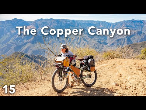
This is a demanding bikepacking route, not a casual sightseeing circuit. The source describes steep, rocky dirt roads, extended climbs, a major descent into Urique, and a challenging return out of the canyon. Allow the source-stated one to two weeks for the Copper Canyon section, plus time to reach it from Chihuahua and continue toward Guachochi. Expect cooler conditions in the mountains and much hotter temperatures at the canyon bottom. The creator adjusts tire pressure for comfort on rough terrain and follows a route recommended by a local friend; a mapped route and full gear list accompany the source materials. Ask permission before passing through private ranch land or gates, and respect Rarámuri residents’ privacy—avoid photographing people without consent.
Resources for this plan
Shared by the source creators. These are not VibePlanit endorsements and may be affiliate links.
Review gear list · Greg McCahon ↗ Creator link · may be an affiliate link
Itinerary highlights
What is in this plan
days 1-2 Chihuahua departure and Cuauhtémoc rest
Start west from Chihuahua and give yourself a recovery day in Cuauhtémoc before tackling the mountain approach. The route begins with dirt roads and climbs; the riders also encountered locked ranch gates, so seek permission rather than assuming a private road is open.
-
Presa El RejónPresa El Rejón, Chihuahua, Chihuahua, Mexico
The ride leaves Chihuahua via Presa El Rejón and nearby dirt roads. This is the source-described start of the westbound ride; the local route recommendation is available in the accompanying route resource.
-
CuauhtémocCuauhtémoc, Chihuahua, Mexico
Use Cuauhtémoc as the first recovery stop after the initial mountain crossing. The riders rested here before continuing toward the Sierra Tarahumara.
days 3-5 Climb through Carichí toward Creel
Allow several days for the uphill approach. The source describes passing through villages, colder mountain conditions, and a frozen river before reaching Creel; pace the climb rather than trying to force a fast schedule.
days 6-7 Creel recovery and canyon approach
Creel is the gateway to the Copper Canyon in this route. The riders rested for a couple of days before setting off toward Barrancas del Cobre; use the break to recover before the rougher canyon section.
-
CreelCreel, Chihuahua, Mexico
Take a recovery stop in Creel before heading deeper into the canyon region. The riders met friends and stayed with a local host before resuming the ride.
-
Barrancas del CobreBarrancas del Cobre, Chihuahua, Mexico
The riders describe Barrancas del Cobre as the destination for the next one to two weeks. Their route first follows dirt roads toward the canyon, with a tough descent and an equally demanding climb back out; reduce tire pressure for comfort on rough ground, as they did.
days 8-11 Cerocahui and descent toward Urique
This leg combines a rainy stop, preparation for the final climb to the canyon rim, and a long descent into Urique. The riders reported a very steep uphill stretch and a descent of roughly 6,000 feet; allow daylight and time for slow progress.
-
CerocahuiCerocahui, Chihuahua, Mexico
Cerocahui was a stop before the final climb toward the canyon rim. The riders used a rainy day here to prepare for the ascent; keep the next stretch flexible for weather and climbing time.
-
UriqueUrique, Chihuahua, Mexico
Urique lies at the bottom of the canyon after a long, winding descent. The temperature rises substantially as the road drops; the riders spent several days relaxing, eating, and exploring local swimming holes, though they did not identify a specific swimming-hole location.
days 12-15 Urique rest and canyon return
Keep time in Urique for recovery before the roughly 6,000-foot climb out. The source shows this return taking multiple difficult days, including rocky sections and bike pushing; adjust the pace to energy and conditions rather than treating the ascent as a single-day ride.
days 16-21 Batopilas to Guachochi
The route reaches Batopilas after several days of canyon riding, then turns toward Guachochi via a paved road and a major climb out. The source reports a visible cartel presence and an unsettling feeling in Batopilas; take current local guidance seriously and reassess conditions before traveling. In the Sierra Tarahumara, respect Rarámuri privacy and the fact that these mountain communities are people’s homes, not simply scenery.
-
BatopilasBatopilas, Chihuahua, Mexico
Batopilas is a historic town beside the river at the bottom of the canyon. The riders took a rest day here before continuing toward Guachochi. They also described feeling uneasy about the visible security presence, so seek current local advice and make an informed decision before visiting.
-
GuachochiGuachochi, Chihuahua, Mexico
Guachochi is the next major stop after Batopilas and the last big stop the riders named on this Sierra section. The route out includes a substantial climb; the source notes that this exit follows a paved road.