

Public travel plan
A Hidden-Gem Road Tripper’s 30-Day Hiking and Landscape Photography Circuit Across the USA
This is an outdoor road-trip itinerary for a self-sufficient hiker, camper, and landscape photographer. Expect long drives, remote trailheads, desert heat, river crossings, elevation gain, and limited cell service. Pack…

Source videos
Travel inspiration behind this plan
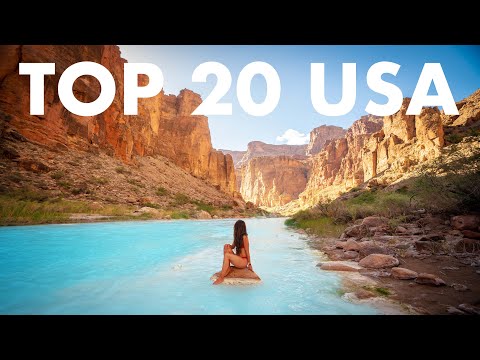
Itinerary highlights
What is in this plan
Days 1-8: Southern Utah, Arizona and Nevada Desert Formations
Base this opening stage around the St. George and Las Vegas corridor before continuing through remote northeastern Arizona and eastern Nevada. Start hikes early or late to reduce desert heat. Carry more water than you expect to need, download offline maps, and avoid exposed routes during storms or extreme heat.
-
Yant Flat Candy CliffsYant Flat Candy Cliffs Trailhead, Washington County, Utah, USA
Hike the 5.3-mile round-trip route with approximately 800 feet of elevation gain through vivid red and orange sandstone formations. The cliffs are part of the Bearpaw Mountains and are especially suited to landscape photography. This is a short drive from St. George and convenient when visiting Zion National Park.
Watch the source moment on YouTube ↗ -
The VortexThe Vortex Trailhead, Ivins, Utah, USA
Take the 2.3-mile hike to the Vortex and its deep bowl. The route gains about 524 feet, has little shade, and stays exposed to the sun, so bring ample water. The creator visited at sunset and found the formation quiet; watch carefully for rattlesnakes and other desert wildlife.
Watch the source moment on YouTube ↗ -
Emerald CoveEmerald Cove Kayaking Launch, Willow Beach, Arizona, USA
Paddle toward the green-water cove on the Colorado River near Hoover Dam. The kayak journey takes roughly one to two hours each way when taken leisurely. Self-guided paddlers receive a map and route instructions with the rental. Go early or later in the day to avoid the larger Las Vegas tour groups.
Watch the source moment on YouTube ↗ -
Hopi Salt TrailHopi Salt Trailhead, Navajo County, Arizona, USA
Treat this as the most demanding route in the itinerary: the stated distance is 8.4 miles, but the creator experienced closer to 11–12 miles with substantial vertical gain, route finding, and Class 3–4 scrambling. The route reaches the Little Colorado River confluence and requires a multi-day permit, remote dirt-road access, and reliable emergency communication. Camp only with the required permit.
Watch the source moment on YouTube ↗ -
Cathedral Gorge State ParkCathedral Gorge State Park, Panaca, Nevada, USA
Explore the narrow clay slot formations on the two-mile Cathedral Gorge Trail and continue into Moon Caves, where the passages become too tight for a backpack. The eroded cathedral-like cliffs and deep ravines offer unusually graphic desert textures.
Watch the source moment on YouTube ↗ -
Alabama HillsAlabama Hills Recreation Area, Lone Pine, California, USA
Use this southern California weekend-style camping base to explore rock formations, natural arches, hiking routes, and climbing areas beneath the Sierra Nevada and Mount Whitney backdrop. The landscape resembles Joshua Tree in places, but the creator favored Alabama Hills for its mountain setting and quieter feel.
Watch the source moment on YouTube ↗
Days 9-15: Great Basin, Black Hills and Colorado High Country
This mountain-and-high-desert stage combines unusual geology, wildlife, hot-water recreation, waterfalls, and a strenuous alpine lake hike. Plan recovery time after Columbine Lake and confirm seasonal access before heading into higher elevations.
-
Bonneville Salt FlatsBonneville Salt Flats Rest Area, Wendover, Utah, USA
Photograph the vast salt crust either as dry hexagonal patterns or, after rain, as a mirror-like surface. The flats are west of Salt Lake City and are associated with high-speed land records and the annual Bonneville Speed Week in August. Stay on permitted surfaces and avoid driving on wet salt.
Watch the source moment on YouTube ↗ -
Promontory PointPromontory Point, Great Salt Lake, Utah, USA
Visit this Great Salt Lake viewpoint for pink water, blue lake tones, trains, land strips, and distant mountains. It is described as especially rewarding for aerial photography, picnicking, and hiking.
Watch the source moment on YouTube ↗ -
Custer State ParkCuster State Park Visitor Center, Custer, South Dakota, USA
Explore the 71,000-acre park for its herd of more than 1,300 bison, plus pronghorn, elk, bighorn sheep, coyotes, and birds. Add hiking, camping, fishing, swimming, mountain biking, horseback riding, picnic areas, and rock climbing. Wind Cave and Jewel Cave are nearby additions, while Mount Rushmore is close enough to pair with the park.
Watch the source moment on YouTube ↗ -
Homestead CraterHomestead Crater, Midway, Utah, USA
Swim, snorkel, scuba dive, or join a yoga or fitness class inside the 55-foot beehive-shaped limestone formation. The geothermal water stays around 90–96°F, and timed entry, changing rooms, showers, and a beach area are available.
Watch the source moment on YouTube ↗ -
Columbine Lake TrailMoloff's Trailhead, Ouray County, Colorado, USA
Begin at Moloff’s Trailhead for the 7.9-mile hike with approximately 2,837 feet of gain through aspen, wildflowers, wildlife, rapids, and alpine scenery. The lake is near Ouray and requires driving the Million Dollar Highway. Pack a picnic or substantial snacks for the top.
Watch the source moment on YouTube ↗
Days 16-22: Volcanic Landscapes, Waterfalls and Texas Dunes
This stage shifts between volcanic terrain, lush waterfalls, sand dunes, granite reservoirs, and bayou wetlands. Keep wet-weather flexibility: Cummins Falls can require advance permits, while flash flooding makes Devil’s Bathtub unsafe during rain.
-
Bandera Volcano and Ice CaveBandera Volcano and Ice Cave, Grants, New Mexico, USA
Visit the volcanic ice caves and hike the accessible 1.8-mile round-trip route to the Bandera volcano summit. The ice caves are open year-round but were described as best in winter, when ice formations are at their peak. Explore the cinder cone, lava tubes, and lava fields.
Watch the source moment on YouTube ↗ -
Rifle FallsRifle Falls State Park, Rifle, Colorado, USA
Stop just off I-70 to photograph the three-tier waterfall: approximately 70 feet, 30 feet, and 40 feet. Explore the surrounding caves, hike around the falls, and consider camping or fishing in Rifle Mountain Park.
Watch the source moment on YouTube ↗ -
Cummins Falls State ParkCummins Falls State Park, Cookeville, Tennessee, USA
Hike the two-mile round-trip route to the 75-foot cascading waterfall and its overlooks. Bring a bathing suit and water shoes because visitors can walk on portions of the cascades and swim. Reserve the required permit in advance; same-day entry can sell out.
Watch the source moment on YouTube ↗ -
Monahans Sandhills State ParkMonahans Sandhills State Park, Monahans, Texas, USA
Climb and sled down the park’s dunes, which reach roughly 50 feet across more than three miles of sand. Sandboards and sand skis were unavailable to the travelers, but the park rented sleds inexpensively; rentals could be left in the box outside the visitor center after use. Stay through sunset.
Watch the source moment on YouTube ↗ -
Watson LakeWatson Lake Park, Prescott, Arizona, USA
Camp beside the Granite Dells and hike the seven-mile Peavine Trail for lake views. The reservoir also supports boating, fishing, kayaking, climbing, picnicking, and camping, but swimming is not allowed. The creator particularly enjoyed scrambling over the granite stacks.
Watch the source moment on YouTube ↗
Days 23-30: Remote Waterways, Appalachia and the Oregon Coast
Finish with a mix of remote water-based photography, forest trails, scrambling, swimming holes, climbing scenery, and rugged coastline. Use sunrise for Caddo Lake, postpone Devil’s Bathtub if rain is possible, and reserve enough time to drive the full Samuel H. Boardman corridor slowly, stopping at every overlook.
-
Caddo Lake State ParkCaddo Lake State Park, Karnack, Texas, USA
Rent a kayak and launch before dawn to photograph the bald cypress and swamp scenery at sunrise. The lake supports kayaking through bayou and wetlands, hiking, picnicking, and wildlife viewing, including alligators, turtles, and many bird species. The nature trail is approximately 1.5 miles round trip.
Watch the source moment on YouTube ↗ -
Devil's BathtubDevil's Bathtub Trailhead, Duffield, Virginia, USA
Take the 3.9-mile route through Jefferson National Forest to the swirling natural pool surrounded by rock walls. The short route is more direct, while the longer option adds route finding. Expect river crossings and no cell service; carry water shoes and an offline map. Do not enter during rain or when flash flooding is possible.
Watch the source moment on YouTube ↗ -
Seneca RocksSeneca Rocks Discovery Center, Seneca Rocks, West Virginia, USA
Hike the 3.5-mile round-trip trail to the narrow ridgeline viewpoint, gaining about 807 feet. This itinerary uses the hiking route rather than a technical climb. The quartzite cliffs rise roughly 900 feet above the Potomac branch and the area also contains more than 350 climbing routes.
Watch the source moment on YouTube ↗ -
Samuel H. Boardman State Scenic CorridorArch Rock Picnic Area, Samuel H. Boardman State Scenic Corridor, Brookings, Oregon, USA
Photograph the 12-mile rugged coastline at a relaxed pace, using the overlooks to capture sea stacks, arches, cliffs, and breaking waves. The half-mile Arch Rock Trail leads to a natural arch and nearby rock formations that resemble small islands. The corridor is particularly well suited to long exposures.
Watch the source moment on YouTube ↗ -
Crowley Lake Stone ColumnsCrowley Lake Stone Columns Trailhead, Mono County, California, USA
Visit the basalt columns beside Crowley Lake for a 4.2-mile route with approximately 515 feet of gain. High-clearance four-wheel drive can shorten the approach; otherwise expect to hike the access road to the beach. Walk between the columns and photograph waves against the volcanic formations. Bring bug spray because swarms of insects were reported near departure.
Watch the source moment on YouTube ↗