

Public travel plan
A Scenic Highway 101 Road Trip Along the Oregon Coast
This is a source-faithful coastal road trip built around Highway 101, dramatic viewpoints, sea stacks, beaches, sand dunes, wildlife, and short walks. Allow flexibility for rapidly changing coastal weather: strong wind…
Source videos
Travel inspiration behind this plan
Plan notes
Useful context before you go
This is a source-faithful coastal road trip built around Highway 101, dramatic viewpoints, sea stacks, beaches, sand dunes, wildlife, and short walks. Allow flexibility for rapidly changing coastal weather: strong wind and rain forced the travelers to skip God's Thumb and Devil's Punch Bowl, so keep exposed stops optional. The route is especially well suited to an RV or road-trip traveler. At Cannon Beach, use designated RV parking in town rather than attempting to park near Haystack Rock; the video notes limited spaces and possible fines of up to $50. Cape Lookout State Park was described as a relatively inexpensive camping option with RV water, sewer, and electricity hookups. At Thor's Well and Natural Bridges, stay away from unstable edges and monitor waves and tides. The Sea Lion Caves admission mentioned was $18 per person. Bring layers, waterproof clothing, sturdy footwear, food for picnic stops, and enough time to wait for clearer weather. No locations have been added based only on visual inference.
Itinerary highlights
What is in this plan
Day 1 — Ecola State Park and Cannon Beach
Begin with the northern coastal viewpoints and trails before settling into Cannon Beach. The Indian Beach Trail and beach-to-beach paths can be exposed and sections have previously been damaged by storms, so avoid cliff edges and adjust the walking plan to conditions.
-
Ecola State ParkEcola State Park, Cannon Beach, Oregon, USA
Start here for sweeping coastal views, Crescent Beach access, sea stacks, and trails through woodland and along the headland. The Indian Beach Trail section is particularly scenic, but keep well back from storm-damaged and exposed edges.

-
Indian Beach TrailIndian Beach Trail, Ecola State Park, Oregon, USA
Use the Indian Beach Trail for a forested coastal walk with frequent ocean views. Some sections were described as washed out and repaired after storms, so do not approach unstable edges.
-
Cannon BeachCannon Beach, Oregon, USA
Walk the broad beach beneath the famous sea stack and look for seabirds, including the puffins mentioned at Haystack Rock. The beach entrance provides a strong framed view of the rock.
-
Haystack RockHaystack Rock, Cannon Beach, Oregon, USA
Visit the beach access around this iconic sea stack for the busiest and most recognizable coastal scene. The area has more cafes and crowds than the town section, and limited RV parking; use town RV parking instead of risking a ticket.
-
Cannon BeachCannon Beach, Oregon, USA
Stop in the town section of Cannon Beach for its picturesque wooden Pacific Northwest buildings. Restaurant prices were described as high, with tips added on top, so treat this as a scenic town stop rather than an inexpensive meal base.
-
Insomnia Coffee Co.Insomnia Coffee Co., Cannon Beach, Oregon, USA
Take a coffee break at this popular cafe, which was noted for welcoming visitors with several golden retrievers. It is a convenient town stop before continuing along Highway 101.
Day 2 — Northern Viewpoints and Cape Lookout
Continue south through the high coastal viewpoints and Cape Lookout area. Keep this day weather-flexible: exposed viewpoints and headlands were difficult in intense rain and wind, while the state park campsite offered a practical base with hookups.
-
Neahkahnie South ViewpointNeahkahnie South Viewpoint, Highway 101, Oregon, USA
Pause at this high roadside viewpoint for a broad view down the Pacific coastline. It has substantial parking and access signs for sections of the Oregon Coast Trail.
-
Cape LookoutCape Lookout, Tillamook County, Oregon, USA
Use the Cape Lookout area as a coastal walking stop with views along the headland. The route is exposed, so postpone the walk when wind or rain makes the cliffs uncomfortable.
-
Tillamook Rock LighthouseTillamook Rock Lighthouse, Oregon Coast, USA
The lighthouse was viewed from the Ecola coastline rather than visited directly. Treat it as a distant sea-stack-and-lighthouse composition from the coastal trail.
-
God's ThumbGod's Thumb, Lincoln City, Oregon, USA
This was named as a planned coastal stop but skipped because severe wind made getting out of the vehicle unsafe. Keep it as a weather-dependent option rather than a fixed commitment.
-
Devil's Punchbowl State Natural AreaDevil's Punchbowl State Natural Area, Otter Rock, Oregon, USA
This was another planned stop abandoned during intense rain and wind. Add it only if conditions improve, because the exposed coastal setting was specifically described as unsuitable in severe weather.
-
Cape Lookout State ParkCape Lookout State Park, Tillamook County, Oregon, USA
Use this state-park camping base for a lower-cost stay beside the beach. The stop was described as having full RV hookups including water, sewer, and electricity, making it practical for longer road trips.
Day 3 — Thor's Well and the Sea Lion Coast
Focus on rugged ocean features and wildlife near Thor's Well and Sea Lion Caves. These are exposed and wave-affected locations: watch the surf, keep away from cliff edges, and allow time for the cave elevator and lookout experience.
-
Thor's WellThor's Well, Cape Perpetua Scenic Area, Yachats, Oregon
Visit at a safe distance for dramatic wave action and the rugged, misty coastline. The water can surge through the opening and spray visitors, and the cliffs were described as dangerous when approached too closely.
-
Sprouting HornSprouting Horn, Cape Perpetua Scenic Area, Oregon, USA
Look for the ocean geyser also referred to as Sprouting Horn. It is part of the same rugged shoreline, so remain well back from the water while waiting for wave bursts.
-
Sea Lion RockSea Lion Rock Viewpoint, Oregon Coast, USA
Stop at the viewpoint to smell and observe the sea lions on the rocks below. The strong smell was used as a clue that the colony was nearby; keep wildlife viewing from the designated overlook.
-
Sea Lion CavesSea Lion Caves, Florence, Oregon, USA
Take the elevator down into America's largest sea cave as described. The cave contains sea lions, seabirds, crashing waves, mist, and interpretive information; the admission mentioned was $18 per person.
-
Sea Lion Caves Whale Watching DeckSea Lion Caves Whale Watching Deck, Florence, Oregon, USA
Use the separate whale lookout above the cave for sea-stack and ocean views. Bring binoculars if desired; the location was described as offering binocular rental or a place to use your own.
-
Sea Lion CavesSea Lion Caves, Florence, Oregon, USA
Look for nesting seabirds in and around the cave, where the travelers also observed an eagle. Keep the wildlife experience observational and remain in the established viewing areas.
Day 4 — Oregon Dunes and Sunset Bay
Move into the extensive dune country before finishing at the sheltered cove of Sunset Bay. The dunes have both walking areas and motorized ATV activity, so use the walking sections described as quieter and keep clear of dedicated vehicle zones.
-
Oregon Dunes National Recreation AreaOregon Dunes National Recreation Area, Oregon, USA
Explore the massive coastal dune field, where dunes were described as reaching over 500 feet and changing shape over time. Use a lookout or walking trail for a quieter experience away from ATV traffic.
-
Oregon Dunes National Recreation AreaOregon Dunes National Recreation Area, Oregon, USA
Use the dune lookout for an elevated view across the shifting sand and coastline. The surrounding area was described as remote, with relatively few people in the walking sections.
-
Oregon Dunes ATV AreaOregon Dunes National Recreation Area ATV Area, Oregon, USA
Observe the ATV activity from a safe distance and stay in the walking areas when exploring on foot. The contrast between the dunes, ocean, and motorized recreation creates the dramatic scene described as resembling Mad Max.
-
Oregon Dunes Campground AreaOregon Dunes National Recreation Area Campgrounds, Oregon, USA
Use the dune walking trails and nearby campsites as a practical overnight phase while continuing south. The source specifically notes that there are many trails and camping options in this area.
-
Sunset Bay State ParkSunset Bay State Park, Coos Bay, Oregon, USA
Finish the day at this sheltered cove, described as one of the better swimming locations on the coast. The surrounding rocks protect calmer water, and the name reflects its sunset appeal.
-
Sunset Bay BeachSunset Bay Beach, Coos Bay, Oregon, USA
Walk the beach and watch the cove as the light changes. The protected rock formations can create flat, calm swimming conditions when the tide is in and the wind is low.
Day 5 — Bandon Beach and Samuel H. Boardman
Continue south toward the more dramatic rock formations around Bandon Beach and the Samuel H. Boardman Scenic Corridor. Plan around afternoon and sunset light, but expect wind on exposed overlooks and use benches and viewpoints when access to the beach itself is not possible.
-
Bandon BeachBandon Beach, Bandon, Oregon, USA
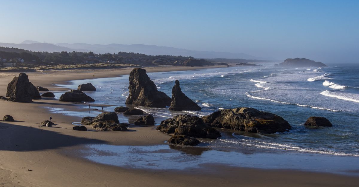
Explore the broad beach and its unusual rock formations. The southern coastline was described as particularly photogenic and reminiscent of the creator's screensaver imagery.
-
Wizard's HatWizard's Hat Rock, Bandon Beach, Oregon, USA
Look for the distinctive Wizard's Hat rock formation from the beach. It was described as a popular sunset photography subject surrounded by additional rock shapes.
-
Samuel H. Boardman State Scenic CorridorSamuel H. Boardman State Scenic Corridor, Oregon, USA
Drive through this scenic corridor for repeated views of rock formations and coastal road scenery. The southern section was described as a highlight of the route rather than merely a transit road.
-
Arch Rock ViewpointArch Rock Viewpoint, Samuel H. Boardman State Scenic Corridor, Oregon, USA
Stop at the overlook for a view across the coastline and the arch below. The nearby picnic benches make this a practical lunch stop, although seagulls may join the picnic.
-
Arch RockArch Rock, Samuel H. Boardman State Scenic Corridor, Oregon, USA
Use the overlook for the full coastline composition rather than expecting a straightforward beach descent. The source specifically noted that the view from the bench was enough even when reaching the beach was unclear.
-
Samuel H. Boardman Scenic Corridor Coastal DriveHighway 101, Samuel H. Boardman State Scenic Corridor, Oregon, USA
Allow extra time for the coastal drive through the corridor itself, where numerous rock formations and ocean views appear between the named stops. Treat these as pull-over opportunities only where safe and permitted.
Day 6 — Secret Beach and Natural Bridges
End at the southern highlights that require the most care: a steep trail to Secret Beach, wave timing around its waterfalls, and an eroded route toward Natural Bridges. Wear stable footwear, watch the tide, and do not climb onto unstable bridge surfaces.
-
Secret BeachSecret Beach, Samuel H. Boardman State Scenic Corridor, Oregon, USA
Follow the relatively short but steep trail down toward this secluded beach. The route was described as especially beautiful and included several waterfalls, so allow time for the descent and return climb.
-
Secret Beach Forest WaterfallSecret Beach Trail, Samuel H. Boardman State Scenic Corridor, Oregon, USA
Look for the waterfall encountered in the forested approach to Secret Beach. The source described three waterfalls in total, with this first one appearing before the beach.
-
Secret BeachSecret Beach, Samuel H. Boardman State Scenic Corridor, Oregon, USA
Explore the beach's waterfall and rock formations only when the surf allows. The travelers emphasized timing movement with incoming waves because the tide can reach the beach area quickly.
-
Natural Bridges TrailNatural Bridges Trail, Samuel H. Boardman State Scenic Corridor, Oregon, USA
Use the marked AllTrails route toward the natural bridge rather than treating the descent as a casual stroll. The approach was described as a narrow goat track with slippery, eroded sections.
-
Natural BridgesNatural Bridges, Samuel H. Boardman State Scenic Corridor, Oregon, USA
Finish the route at the natural bridge viewpoint for broad views of scattered rocks and the southern coastline. Erosion and slippery ground were specifically noted, so remain on stable surfaces and do not climb onto the arch.
-
Natural Bridges ViewpointNatural Bridges Viewpoint, Samuel H. Boardman State Scenic Corridor, Oregon, USA
Use this viewpoint for the safest final composition of the bridge and surrounding coastline. Although it may be possible to walk onto the arch, the source strongly cautioned against doing so because of erosion and slippery conditions.