

Public travel plan
American Wilds: An Overland Nomad & Trailblazer Journey
This overland and backcountry expedition spans diverse American wilderness hubs—from the Chihuahuan desert ridges of Far West Texas to the ancient hardwood canopies of the Smokies, the crystalline shores of Lake Superio…
Source videos
Travel inspiration behind this plan
 Hiking Medicine Bow Peak | Camping & Cooking in Wyoming’s Snowy Range
Watch on YouTube
Hiking Medicine Bow Peak | Camping & Cooking in Wyoming’s Snowy Range
Watch on YouTube
 The Devils Tower is Not What You Think
Watch on YouTube
The Devils Tower is Not What You Think
Watch on YouTube
 Backcountry Camping in Big Bend National Park — Texas at Its Wildest
Watch on YouTube
Backcountry Camping in Big Bend National Park — Texas at Its Wildest
Watch on YouTube
 The Best Mountain Biking in Copper Harbor (Episode15)
Watch on YouTube
The Best Mountain Biking in Copper Harbor (Episode15)
Watch on YouTube
 Wyoming-The Perfect Dispersed Camping for Nomads
Watch on YouTube
Wyoming-The Perfect Dispersed Camping for Nomads
Watch on YouTube
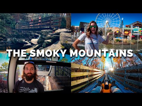 We Spent 48 Hours in the Great Smoky Mountains
Watch on YouTube
We Spent 48 Hours in the Great Smoky Mountains
Watch on YouTube
 Camping and Mountain Biking in the Wild West (Terlingua, Texas)
Watch on YouTube
Camping and Mountain Biking in the Wild West (Terlingua, Texas)
Watch on YouTube
 The Hidden Gem of Wisconsin: Devils Lake State Park
Watch on YouTube
The Hidden Gem of Wisconsin: Devils Lake State Park
Watch on YouTube
 We Found a Crashed Airplane Deep in the Arkansas Wilderness
Watch on YouTube
We Found a Crashed Airplane Deep in the Arkansas Wilderness
Watch on YouTube
 The Beauty of Pictured Rocks National Lakeshore (Episode 11)
Watch on YouTube
The Beauty of Pictured Rocks National Lakeshore (Episode 11)
Watch on YouTube
Plan notes
Useful context before you go
This overland and backcountry expedition spans diverse American wilderness hubs—from the Chihuahuan desert ridges of Far West Texas to the ancient hardwood canopies of the Smokies, the crystalline shores of Lake Superior, and the alpine scree slopes of Wyoming's Snowy Range. Pack modular, four-season camping gear capable of handling dry desert temperature drops, sudden alpine squalls, and humid lakeside evenings. Ensure high-clearance vehicle capability for rugged backcountry access roads in Big Bend and Medicine Bow. Always download offline topographical maps, carry redundant water filtration systems, secure bear-proof food storage where mandated, and practice strict Leave No Trace ethics across all dispersed and established campsites.
Itinerary highlights
What is in this plan
Days 1-3: Chihuahuan Desert Trails & Big Bend Backcountry
Base yourself in the Terlingua and Lajitas desert corridor for high-desert mountain biking, camp cooking under dark skies, and self-sufficient backcountry overland exploration inside Big Bend National Park. Maintain at least one gallon of potable water per person per day and confirm high-clearance 4WD requirements before venturing onto remote primitive park roads.
-
Lajitas TrailsLajitas Trails, Lajitas, TX 79852
Tackle the fast, flowing desert singletrack loops that weave through rugged terrain and arroyos with expansive views of the desert bluffs. Ride early in the morning to beat the midday heat.
Watch the source moment on YouTube ↗ -
Rancho Topanga CampgroundRancho Topanga Campground, Terlingua, TX 79852
A prime camp base near Terlingua offering spacious tent setups, unobstructed night sky panoramas, and fiery desert sunsets over the Chisos Mountains. Perfect for cast-iron skillet campfire dinners.
Watch the source moment on YouTube ↗ -
Terlingua Ghost TownTerlingua Ghost Town, Terlingua, TX 79852, United States
Explore the historic mining ruins, local art porches, and open-air cantinas in this classic ghost town hub before stocking up on provisions for remote backcountry routes.
Watch the source moment on YouTube ↗ -
Big Bend National Park BackcountryBig Bend National Park, TX
Journey deep down long primitive dirt tracks to pitch a completely off-grid camp surrounded by sheer silence, desert peaks, and world-class Class 1 dark sky starfields.
Watch the source moment on YouTube ↗ -
Santa Elena Canyon TrailSanta Elena Canyon Trail, Big Bend National Park, TX 79834
Hike into the towering 1,500-foot limestone canyon walls carved by the Rio Grande along the international border. Best photographed in soft morning light when reflections shimmer on the water.
Watch the source moment on YouTube ↗ -
Panther Junction Visitor CenterPanther Junction Visitor Center, Big Bend National Park, TX 79834
Stop at the central park hub to register for backcountry primitive camping permits, consult rangers on unpaved road conditions, and top up water jugs.
Watch the source moment on YouTube ↗
Days 4-5: Ouachita Mountain Forest & Historical Deep Trek
Transition northeast into the lush ridges and dense mixed pine-hardwood forests of western Arkansas. This phase centers on backcountry navigation through remote terrain to historic forest sites, followed by local comfort food in the gateway town of Mena.
-
1973 Plane Crash Site TrailOuachita National Forest, Mena, AR 71953
Trek through deep, dense Ouachita mountain wilderness on an 11-mile round-trip expedition with off-trail navigation to inspect the historic 1973 turboprop plane wreckage preserved in the forest canopy.
Watch the source moment on YouTube ↗ -
The OuachitasThe Ouachitas, 808 Mena St, Mena, AR 71953
Unwind in downtown Mena after your long backcountry trek with craft coffee, artisanal pizzas, craft brews, and hearty comfort food in a cozy mountain town atmosphere.
Watch the source moment on YouTube ↗ -
Queen Wilhelmina State ParkQueen Wilhelmina State Park, 5250 AR-88, Mena, AR 71953
Drive the crest of the Talimena National Scenic Byway to Rich Mountain, the second highest peak in Arkansas, for panoramic views across rolling blue ridge lines.
Watch the source moment on YouTube ↗ -
Shady Lake Recreation AreaShady Lake Recreation Area, Athens, AR 71921
Pitch camp under towering pines at this peaceful campground nestled along a spring-fed river, offering shaded sites and direct access to Ouachita trail networks.
Watch the source moment on YouTube ↗ -
Little Missouri FallsLittle Missouri Falls, Langley, AR 71952
A short, scenic hike leads to a pristine multi-tiered forest cascade and swimming hole set in an amphitheater of moss-covered rocks.
Watch the source moment on YouTube ↗ -
Skyline CafeSkyline Cafe, 618 Mena St, Mena, AR 71953
Grab morning espresso, fresh breakfast bites, and trail snacks at this local spot right off the historic highway before setting out on your cross-state drive.
Watch the source moment on YouTube ↗
Days 6-7: Great Smoky Mountains Ridges & Foothills
Spend 48 hours exploring the ancient, mist-shrouded crests of the Great Smoky Mountains National Park combined with thrill attractions in the foothills of Pigeon Forge. Start early on trailheads along Newfound Gap Road to secure parking before peak mid-morning crowds.
-
Chimney Tops TrailheadChimney Tops Trailhead, Newfound Gap Rd, Gatlinburg, TN 37738
Hike the steep, iconic stone-step trail through old-growth spruce-fir forest along the Sugarland Mountain ridge to the dramatic observation deck overlooking the pinnacle rocks.
Watch the source moment on YouTube ↗ -
The Great Smoky Mountain WheelThe Island in Pigeon Forge, 131 The Island Dr, Pigeon Forge, TN 37863
Ride 200 feet above the foothills in climate-controlled glass gondolas for sweeping 360-degree vistas across Pigeon Forge and the towering Smoky Mountain ridgeline.
Watch the source moment on YouTube ↗ -
Smoky Mountain Alpine CoasterSmoky Mountain Alpine Coaster, 867 Wears Valley Rd, Pigeon Forge, TN 37863
Control your own descent speed down over a mile of twisting stainless steel tracks weaving dynamically through lush mountain woodlands.
Watch the source moment on YouTube ↗ -
Clingmans Dome Observation TowerClingmans Dome Observation Tower, Bryson City, NC 28713
Stand at the highest point in the Great Smoky Mountains National Park (6,643 ft) on a circular concrete observation tower with endless views over rolling sea-of-clouds ridges.
Watch the source moment on YouTube ↗ -
Elkmont CampgroundElkmont Campground, 434 Elkmont Rd, Gatlinburg, TN 37738
Camp under mature hemlock and maple trees alongside the rushing Little River, one of the most scenic year-round campgrounds in the park.
Watch the source moment on YouTube ↗ -
Sugarlands Visitor CenterSugarlands Visitor Center, 1420 Fighting Creek Gap Rd, Gatlinburg, TN 37738
Stop for maps, natural history exhibits, and trail condition updates near the Gatlinburg entrance to the park.
Watch the source moment on YouTube ↗
Days 8-11: Northwoods, Lake Superior Cliffs & Keweenaw MTB
Head into the pristine Upper Midwest and Michigan's Upper Peninsula. Experience the quartzite bluffs of Devil's Lake, cruise past Pictured Rocks' mineral-stained cliffs on Lake Superior, sample local Upper Peninsula fare, and ride world-famous singletrack along the Keweenaw Peninsula.
-
Devil's Lake State ParkDevil's Lake State Park, S5975 Park Rd, Baraboo, WI 53913
Hike the dramatic East Bluff Trail among ancient purple quartzite rock formations like Balanced Rock and Devil's Doorway overlooking the 360-acre spring-fed lake.
Watch the source moment on YouTube ↗ -
New Life Lavender & Cherry FarmNew Life Lavender & Cherry Farm, E10766 County Rd U, Baraboo, WI 53913
Wander through 25 acres of organic lavender fields and wildflower orchards while enjoying lavender soft-serve ice cream and homemade treats.
Watch the source moment on YouTube ↗ -
Driftless Glen DistilleryDriftless Glen Distillery, 300 Water St, Baraboo, WI 53913
Tour the grain-to-glass distillery sitting along the Baraboo River and savor bourbon tastings alongside elevated farm-to-table cuisine.
Watch the source moment on YouTube ↗ -
Pictured Rocks CruisesPictured Rocks Cruises, 100 City Park Dr, Munising, MI 49862
Board a passenger boat tour out of Munising harbor to witness towering sandstone cliffs, sea caves, and mineral water streaks illuminated by the late afternoon sun.
Watch the source moment on YouTube ↗ -
Kingston Lake State Forest CampgroundKingston Lake Campground, Adams Trail, Shingleton, MI 49884
Set up camp at this serene rustic state forest campground nestled on an inland lake within walking distance of Lake Superior dunes.
Watch the source moment on YouTube ↗ -
Gallery Coffee CompanyGallery Coffee Company, 110 W Superior St, Munising, MI 49862
Fuel your morning with in-house roasted specialty espresso, pour-overs, and freshly baked pastries in downtown Munising.
Watch the source moment on YouTube ↗ -
East Channel Brewing CompanyEast Channel Brewing Company, 209 Maple St, Munising, MI 49862
Sample small-batch IPAs, stouts, and seasonal ales brewed with Lake Superior water in a laid-back, community-centric taproom.
Watch the source moment on YouTube ↗ -
Tracey's at Roam InnTracey's, 19 E Munising Ave, Munising, MI 49862
Indulge in seasonal Great Lakes whitefish, craft steaks, and refined regional dishes inside the historic Roam Inn.
Watch the source moment on YouTube ↗ -
Copper Harbor Trails ClubCopper Harbor Trails, Copper Harbor, MI 49918
Ride world-class mountain bike terrain featuring technical rock gardens, root drops, flow lines, and ridge boardwalks high above Lake Superior.
Watch the source moment on YouTube ↗ -
The Berry PatchThe Berry Patch, 222 5th St, Copper Harbor, MI 49918
Treat yourself after a long trail ride to delicious Italian gelato, thimbleberry ice cream, and espresso near the harbor.
Watch the source moment on YouTube ↗ -
Copper Harbor Mini GolfCopper Harbor Mini Golf, Gratiot St, Copper Harbor, MI 49918
Enjoy a fun round of miniature golf tucked under the Keweenaw canopy right in the heart of town.
Watch the source moment on YouTube ↗
Days 12-14: Snowy Range Alpine Summits & Devils Tower
Conclude in Wyoming's high country. Dispersed camp amidst alpine meadows in Medicine Bow National Forest, scramble across the Snowy Range crest to Medicine Bow Peak (12,013 ft), watch for foraging moose at Mirror Lake, and visit the iconic columnar phonolite monolith at Devils Tower.
-
Medicine Bow National Forest Dispersed CampingMedicine Bow National Forest, WY-130, Saratoga, WY 82331
Set up a self-contained nomad base in designated dispersed camping areas along USFS dirt corridors under lodgepole pines with direct access to alpine streams and peak views.
Watch the source moment on YouTube ↗ -
Mirror Lake Picnic GroundMirror Lake Picnic Ground, WY-130, Centennial, WY 82055
Marvel at the crystal-clear alpine waters mirroring the sheer quartzite face of Medicine Bow Peak. Keep a keen lookout in the willow wetlands for resident bull moose feeding at dawn and dusk.
Watch the source moment on YouTube ↗ -
Medicine Bow Peak TrailheadMedicine Bow Peak Trailhead, Centennial, WY 82055
Embark on an exhilarating high-altitude loop hike scrambling across boulder talus fields and alpine tundra to reach the 12,013-foot summit ridge.
Watch the source moment on YouTube ↗ -
Devils Tower National MonumentDevils Tower National Monument, Wyoming, United States
Hike the 1.3-mile paved Tower Trail circling the base of the massive igneous rock buttress to view giant hexagonal columns and climbers ascending sheer vertical cracks.
Watch the source moment on YouTube ↗ -
Keyhole State ParkKeyhole State Park, 22 Keyhole Dr, Moorcroft, WY 82721
Camp along the shores of Keyhole Reservoir surrounded by rolling pine-covered hills, offering great water access, boating, and restful stargazing.
Watch the source moment on YouTube ↗ -
Devils Tower Visitor CenterDevils Tower Visitor Center, Devils Tower, WY 82714
Browse indigenous art, geology exhibits, and climbing history displays inside the historic log-built visitor center at the base of the tower.
Watch the source moment on YouTube ↗